
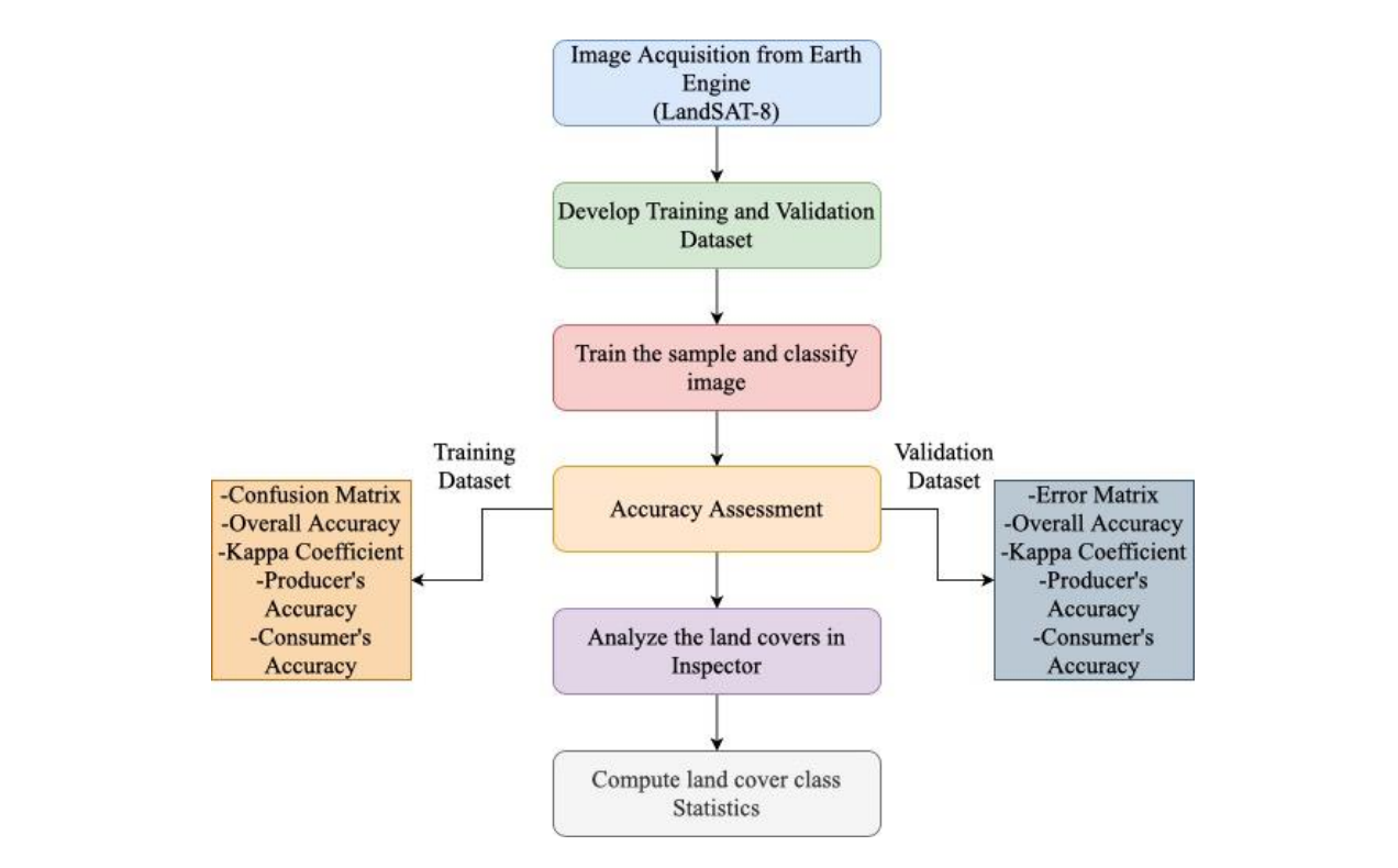

This study was done to detect the landcover changes in Kathmandu Valley in reference to three years 2013, 2017 and 2021 AD. The base data used for this analysis was Landsat8 Collection 1 Tier 1 TOA datasets of the respective years. A python based package named geemap was used which is based on Google Earth Engine.
Key Highlights
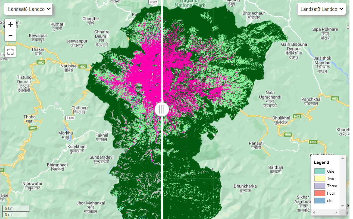
- Interactive Landcover visualization categorized into five classes.
- Layer Toggler to turn on and off different layers and basemaps.
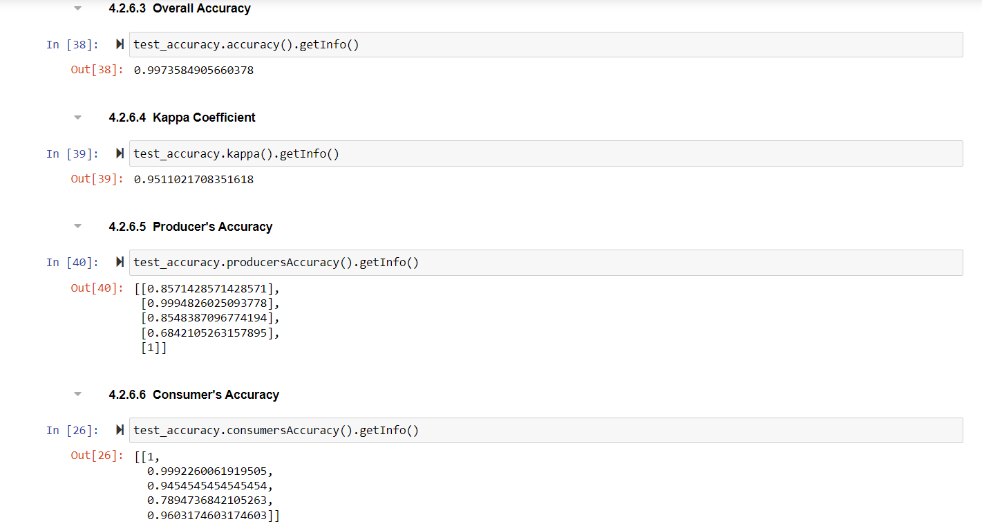
- Overall, Consumers and Producers Accuracy and Kappa Coefficient.
- Randforest SmileCart Classifier Algorithm.
- Zonal Statistics as an output.
- Analyze different year landcovers in inspector.